
Land Surveying Services in Bowling Green, KY
Accurate surveying gives every property transaction, development plan, and construction project a dependable starting point. At Landmark Engineering, we provide land surveying services throughout Bowling Green, Warren County, South Central Kentucky, and nearby Tennessee communities for commercial developers, residential builders, property owners, attorneys, lenders, and public agencies. Since 2004, our team has served clients across Kentucky and Tennessee with precise fieldwork, clear documentation, and responsive communication. Led by owner and president Thaddaeus J. Lucas, PE, PLS, we combine experienced land surveyors with modern GPS tools, aerial information, and practical local knowledge.
Reliable Measurements Before Major Decisions
Property boundaries, elevations, easements, improvements, and existing site conditions can affect what may be purchased, divided, financed, designed, or built. Relying on old records, informal markers, or assumptions may create disputes and expensive changes later.
A professional land survey provides verified information that supports better decisions. Our surveyors review available records, complete appropriate field measurements, and prepare the drawings or documents required for the project.
Boundary Surveys for Property Clarity
A boundary survey identifies the limits of a parcel using deeds, recorded plats, monuments, field evidence, and applicable surveying standards. It may be needed before buying land, installing improvements, dividing property, resolving a dispute, or beginning construction near a property line.
We provide boundary surveys in South Central Kentucky and nearby Tennessee Communities for residential and commercial properties. Our team works carefully to reconcile field evidence with recorded information and clearly document the results.
Property Line Surveys for Homeowners
Homeowners often request a property line survey before building a fence, driveway, garage, addition, or outdoor improvement. Knowing the boundary location may help prevent accidental encroachment onto neighboring land or into an easement.
Our residential surveyors explain the process and the type of survey appropriate for the situation. We focus on providing useful, understandable information rather than leaving property owners with technical documents they cannot interpret.
Topographical Surveys and GPS Mapping
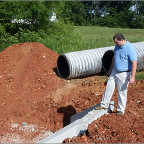
A topographical survey records the physical characteristics of a site, including ground elevations, contours, structures, utilities, pavement, drainage features, vegetation, and other visible improvements. Engineers, architects, landscape architects, and developers use this information when evaluating design and grading options.
Our topographical surveys and GPS mapping combine field experience with modern technology. Accurate existing-condition data helps design teams identify constraints early and create plans that respond to the actual property.
ALTA and Land Title Surveys
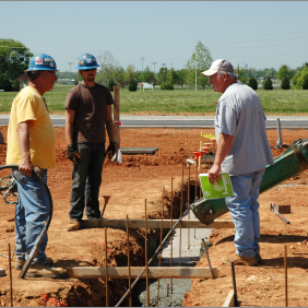
Commercial real estate transactions often require a detailed survey that meets national standards established for lenders, title companies, buyers, and attorneys. An ALTA survey may document boundaries, easements, access, improvements, encroachments, utilities, and other conditions affecting the property.
We provide ALTA/NSPS land title surveys based on the current requirements of the transaction. Our team coordinates with the client and other parties to identify the required survey items before fieldwork and drafting begin.
Construction Layout and Staking
Construction plans must be translated accurately from drawings to the physical site. Incorrect placement of buildings, roads, utilities, foundations, or grading features can create costly rework and schedule delays.
Our construction layout services establish the points, lines, elevations, and offsets contractors need in the field. We coordinate with project plans and construction teams to help ensure improvements are placed where the approved documents require.


Modern Technology Guided by Field Experience
Advanced tools improve efficiency, but reliable surveying still depends on professional judgment. GPS equipment, aerial photography, digital data collection, and mapping software must be used alongside careful research and experienced field interpretation.
Our team combines current surveying technology with seasoned leadership. This balance helps us produce precise, practical surveying products for properties ranging from individual residential lots to complex development sites.
A Surveying Scope Built Around the Project
We also tailor the scope to the actual project requirements. This helps clients receive the information they need without paying for unrelated services.

Why Choose Landmark Engineering?
Landmark Engineering has served commercial and residential developers across Kentucky and Tennessee since 2004. Our daily work is guided by honesty, integrity, promptness, precision, and a commitment to the communities where we live and work.
Clients choose our land surveyors for:
Reliable Information for Confident Decisions
We understand that surveying affects legal rights, budgets, approvals, and construction schedules. Our goal is to provide reliable information that allows each client to move forward with confidence.
Start Your Project With Accurate Surveying
A dependable survey can prevent disputes, clarify property rights, support approvals, and keep construction moving in the right location. Landmark Engineering provides boundary surveys, topographical mapping, ALTA land title surveys, GPS services, subdivision layout, construction staking, plat recording, and as-built plans throughout Bowling Green and South Central Kentucky. We combine more than 20 years of regional experience with modern technology, professional judgment, and honest communication. Contact our team today to discuss your property and begin your project with accurate information from a trusted local surveying partner.